Adriatic-Ionian Route

Interreg Italy-Croatia 2021-2027 — CYROS

The project is co-financed by the European Union under the Interreg Italy-Croatia 2021-2027 programme.

The Adriatic-Ionian Cycling Route in the Istrian County was mapped out as part of the EU CYROS project from the Interreg Italy-Croatia 2021-2027 programme. The route follows the Istrian coast (mostly aligned with the EuroVelo 8 route), connects with Slovenia and Italy and continues through the Primorje-Gorski Kotar County, integrating various forms of transport (bicycle, ferry, bus, train). It was developed in accordance with the European certification standard for long-distance cycling routes.

On this page you can download the GPX file of the entire route and individual sections and find the most interesting attractions.

Interactive map


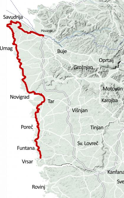
  • E1 Plovanija–Vrsar
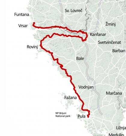
  • E2 Vrsar–Pula
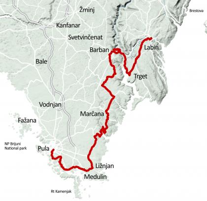
  • E3 Pula–Labin
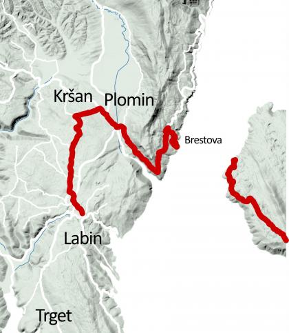
  • E4 Labin–Brestova

Click on a stage in the legend to hide or show it again.

Daily stages


The daily sections are designed as stages that most users will be able to complete in one day. They range in length from 60 to 80 kilometers and are designed in line with the proposed EuroVelo 8 route.
E1

Plovanija–Vrsar

Length: 69,4 km Cumulative climb: 765 m
Stage map: Plovanija–Vrsar

The Adriatic-Ionian Cycling Route enters Croatia at the Sečovlje/Plovanija border crossing, and the first 5 kilometers follow the route of the popular cycling trail "Parenzana", the former famous narrow-gauge wine railway that connected Trieste and Poreč from...

E2

Vrsar–Pula

Length: 86,1 km Cumulative climb: 1.095 m
Stage map: Vrsar–Pula

The Adriatic-Ionian route from Vrsar leads past one of the most beautiful natural phenomena of Istria – the Lim Bay, and passes by the attractive sports airport in Vrsar. From here it continues along the marked Eco bike trail Vrsar – Lim through the pleasant s...

E3

Pula–Labin

Length: 78,9 km Cumulative climb: 1.352 m
Stage map: Pula–Labin

The route from Pula leads through the Medulin Riviera, and in Vinkuran it passes by the old Roman quarry (Cava Romana) from where the stone was brought for the construction of the monumental amphitheater in Pula. In Banjole you can turn off the route south to...

E4

Labin–Brestova

Length: 52,8 km Cumulative climb: 1.340 m
Stage map: Labin–Brestova

On the Labin – Rijeka road is the Dubrova Sculpture Park, located on a 17th-century Baroque country estate. Through the village of Vrećari, from where there is a view of the impressive Učka ridge, you enter Nedešćina. The route from Nedešćina leads along a win...

1. Labin–Brestova — 27 km / 591 m  ·  2. Porozina–Cres — 25,8 km / 749 m